|
|
|
|
In 1983,
Oceanweather (OWI) was approached to produce a wind and
wave forecast for the Discoverer Seven Seas which was one
of the largest drillships in the world. OWI had already
built a reputation for pioneering the hindcast approach
in developing metocean criteria for structure design as
well as developing new wind, wave and tropical models. The
result was the first operational forecast system which computed
vessel response, an approach that is being "rediscovered"
even today.
|
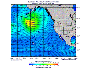
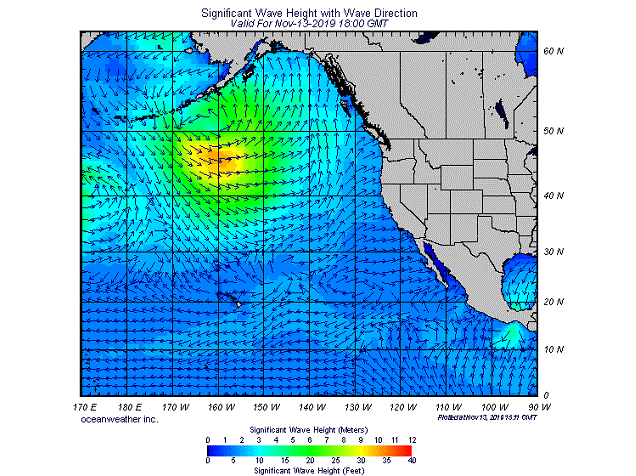
Significant
Wave Height Forecast
|
|
Since
then, OWI forecasting has rapidly expanded. In the late
1980's, the operational forecast was extended to the North
Atlantic and North Pacific. A partnership with
C-MAP
produced the first onboard optimum ship routing
system which has continued to evolve into today's Vessel
and Voyage Optimization Solution (VVOS).
In the 1990's, forecasting was extended to global coverage
and regional high-resolution nested models began operational
use. The first global wave graphics on the Internet appeared
in 1994 as Oceanweather unveiled its Current
Marine Data web site for the maritime community.
|
|

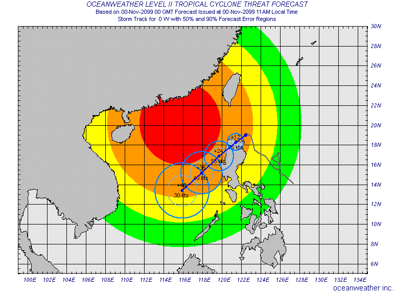
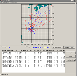
CYCLOPS
Storm Track
|
Today,
OWI runs its global wind and wave models twice per day out
to a forecast horizon of 15 days. Multiple high-resolution
nested wave models are run up to 4 times per day to service
the CYCLOPS product
and provide weather
data and graphics including Meteograms, API parameters,
and OWI's SquallCast via email or web portal access to
companies worldwide. Ensemble
wind and wave forecasts out to five weeks issued once per
week are available globally. OWI continues
to improve the models and techniques used in producing
forecasts and remain at the cutting edge of global marine
forecasting.
|
OWI
has always maintained that the best forecasts are produced
by experienced marine meteorologists. Hence, the OWI operational
forecast system has evolved to provide the best possible
tools for our forecast team.
|
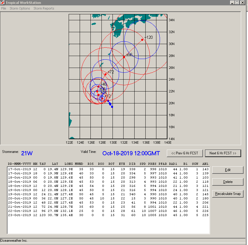
Tropical
WorkStation
|
Forecast
Runstream
|
|
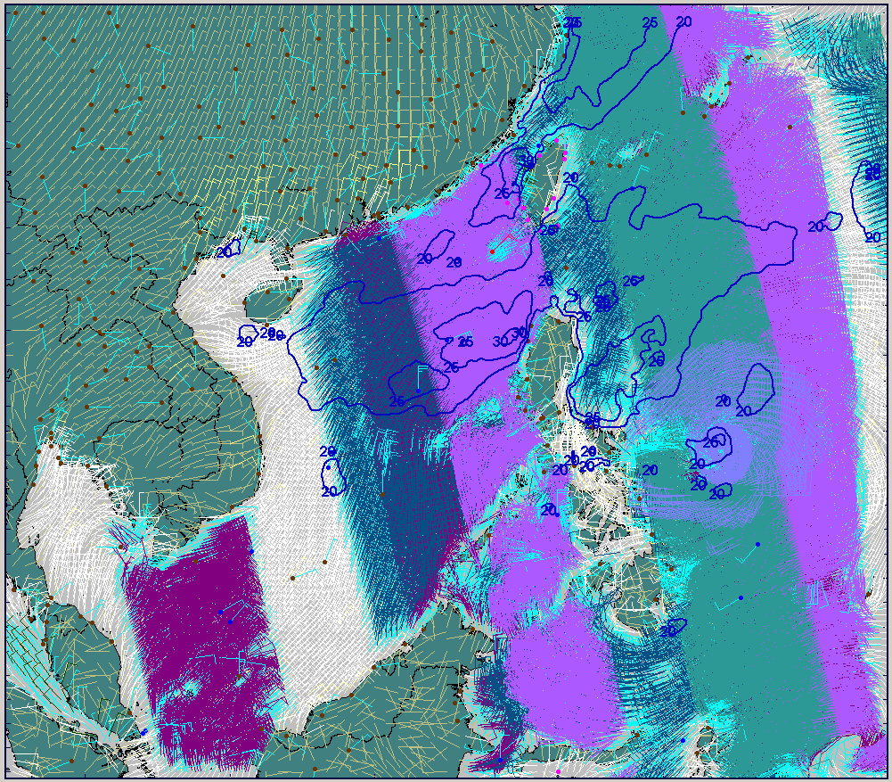
South
China Sea Regional Wind
WorkStation
|
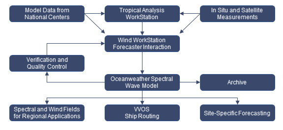
Forecast
data and marine observations are continuously collected by
OWI. Model data from the NCEP (US), US
Navy, ECMWF (Europe) and others are routinely evaluated
by the forecast team. Observational data from buoys, ships,
coastal stations, and satellite measurements of winds and
waves are incorporated in the Wind WorkStation (WWS) for
both global and regional applications. Tropical forecasts
from national centers are used to drive OWI's tropical model
which produces high-resolution tropical wind fields. All
of this data is presented in the WWS where the forecaster
evaluates the current situation and makes enhancements to
the marine surface wind fields.
|
The
enhanced wind fields are then run through one of OWI's spectral
wave models. Currently, our global model is run twice per
day and several high-resolution nested models are run up to
four times per day. The resulting wave fields are then validated
in realtime against all available observational data.
Output
from OWI's forecast is used for a variety of purposes, many
of which are detailed on our main
forecast web page. We provide operational data for container
vessels, offshore oil platforms, web sites, onboard display
programs, in-house applications and many others.
Archived
data is routinely used for post-voyage analysis, tow simulations
and other applications that require near-realtime wind and
wave data.
|
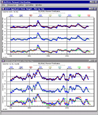
Realtime
verification
|
|
Forecast-related
Publications and Papers
Cox, A.T.,
B.T. Callahan, M. Ferguson and M.A. Morrone (2017) Tropical
Cyclone Wind Field Analysis for Ocean Response Modeling: Hurricane
Harvey (2017). 1st International Workshop on Waves,
Storm Surges and Coastal Hazards, Liverpool, UK, 10-15 September 2017.
Cox, A.T.,
2015. Classification
of Radial Wind Profiles for Gulf of Mexico Tropical Cyclones
14th International Workshop on Wave Hindcasting and Forecasting
& 5th Coastal Hazard Symposium, Key West, Florida November
8-13, 2015.
Graber,
H.C., V.J. Cardone, R.E. Jensen, D.N. Slinn, S.C. Hagen, A.T.
Cox, M.D. Powell, and C. Grassl, 2006 : Coastal
Forecasts and Storm Surge Predictions for Tropical Cyclones:
A Timely Partnership Program, Oceanography, vol.
19 no. 1, pp. 130-141.
Cox,
A.T. and V.J. Cardone. 20
Years of Operational Forecasting at Oceanweather. 7th
International Workshop on Wave Hindcasting and Forecasting
October 21-25, 2002, Banff, Alberta, Canada.
Cox,
A.T. and V.J. Cardone. Operational
System for the Prediction of Tropical Cyclone Generated
Winds and Waves. 6th International Workshop
on Wave Hindcasting and Forecasting November 6-10, 2000,
Monterey, California.
Cox,
A.T., V.J. Cardone and D.T. Resio. Coastal
Wave Prediction for Cape Canaveral, Florida.
3rd Conf. on Coastal Atmo. and Oceanic Prediction and Processes.
Nov. 3-5, 1999, New Orleans.
Corona,
E.N, R. D. Lynch, D. Riffe, V. J. Cardone and A. T.Cox.
Typhoon
Emergency Response Planning for the South China Sea.
OTC 8117. Offshore Technology Conference. 6-9 May, 1996,
Houston Texas, 855-868.
For
a complete list of OWI publications please view our Recent
Publications web page.
|
|