PERGOS-3 Hindcast Available for the Persian Gulf Region
We are pleased to announce the availability of PERGOS-3, Oceanweather's (OWI's) follow-up to the PERGOS and PERGOS-2 metocean hindcasts for the Persian Gulf. This continuous hindcast archive spans the period 1960 through 2024 and has been produced using our decades of experience in atmospheric reanalysis and ocean response modeling in the region. For the hindcast, the ADCIRC+SWAN modeling system was implemented in the relatively shallow Gulf domain to capture tidal and storm surge water level variation and incorporate it in the wave model response. Wind, pressure, bulk wave, water level and current parameters are available as time series at individual points in addition to available operability and extreme value analyses.
- Archive Time Step: 1-hour
- Hindcast Period: 1960-01-01 through 2024-12-31 (continuous)
- Variables: Met., Wave and Hydro.
- Spatial Resolution: 500m-6km (unstructured mesh)
- Latitude Coverage: \(23.14^{\circ}\) to \(30.5^{\circ}\) N
- Longitude Coverage: \(47^{\circ}\) to \(56.4^{\circ}\) E
- Met. forcing: ERA5 with statistical corrections and kinematic analyses
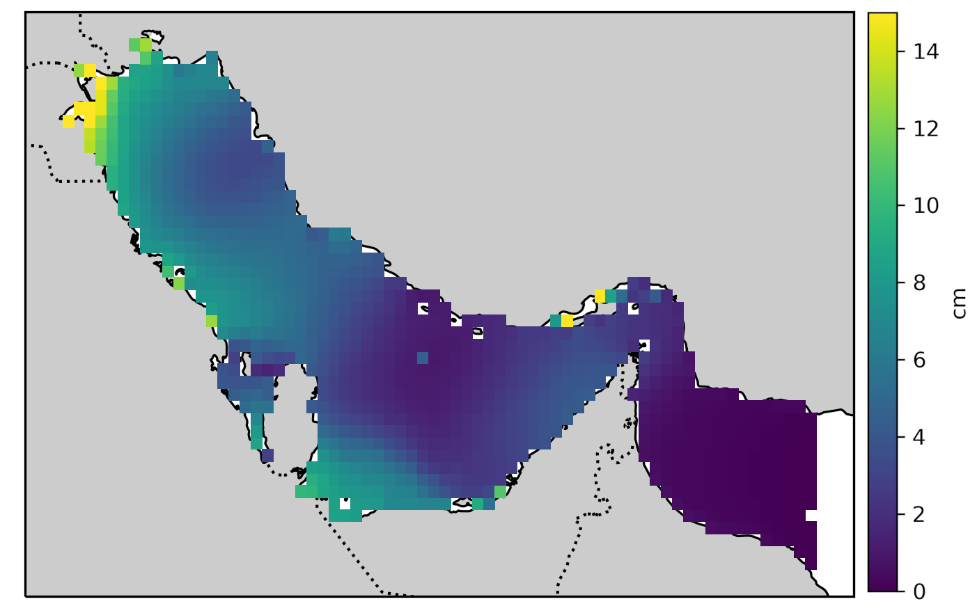
- Tidal boundary: TPXO9 forced from the Gulf of Oman
- Previous Hindcasts:
- PERGOS (2005) 1983-2009 (+ earlier storms)
- PERGOS-2 (2018) 1979-2018 (+ earlier storms)
Domain
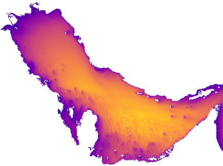
Gridded topo-bathy datasets were used in conjunction with the Matlab-based OceanMesh2D toolbox to generate the PERGOS-3 unstructured mesh. This process applies parametric constraints related to depth, slope, nearshore proximity and element quality to optimize the mesh for hydrodynamic modeling in an objective data-based and reproducible way. While the model domain was designed to include the Gulf of Oman, the PERGOS-3 archive is available for the region within and west of the Strait of Hormuz only. Final mesh depths were compared against available BA and DMA chart soundings when possible.
Winds
Statistical corrections were developed using the ASCAT(-B,-C), OCEANSAT2, and RAPIDSCAT instrument wind speed (WS) measurements over the 8-year period 2014-2021 compared to coincident ERA5 winds (10m height effective-neutral stability). Similar statistical assimilation of scatterometry into ERA5 has been successfully applied by OWI in basins around the globe.
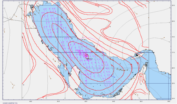
Individual storm events cannot reliably be addressed soley through adjustments based on systematic error statistics, and require kinematic reanalyses examining the spatio-temporal evolution of the wind field with respect to measurements. Kinematic analysis was performed for each of a population of 189 significant storms over 1960-2024 using OWI’s Wind WorkStation (WWS) Interactive Objective Kinematic Analysis (IOKA) methodology. This approach, pioneered to develop climatologies for offshore design, was recognized as producing the best “reference” wind fields in early field programs and associated ocean response modeling experiments, and continues to be used as such in numerous recent studies by government, academia and industry.
Hindcast Skill
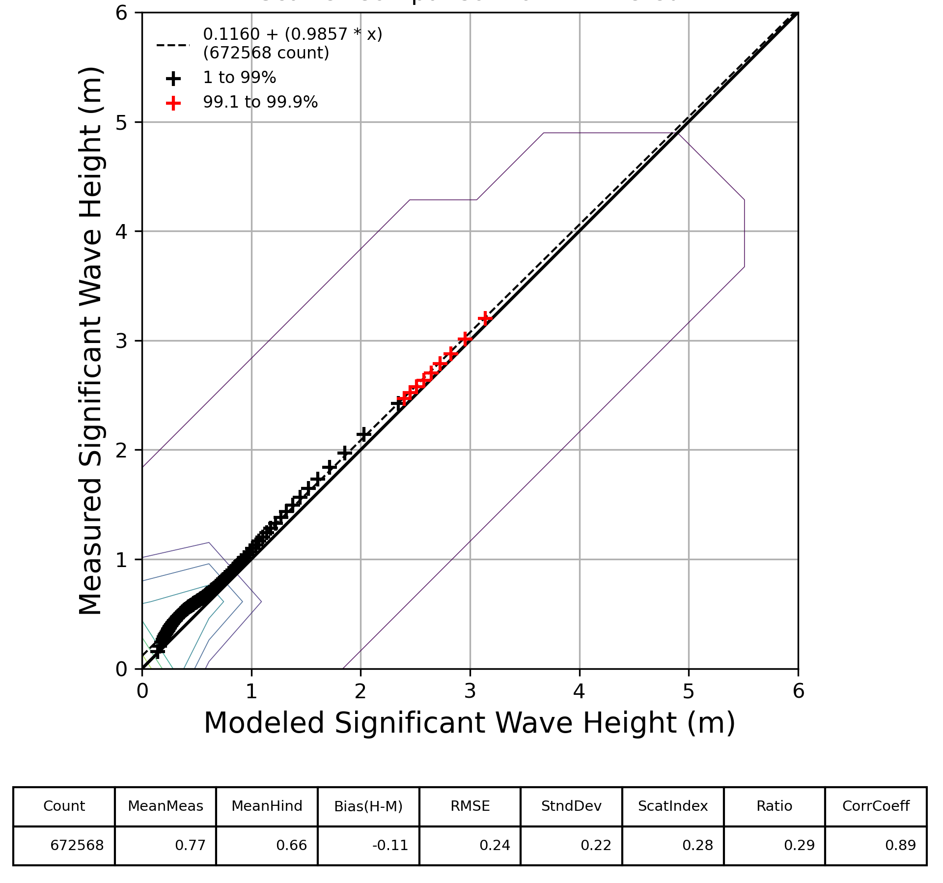
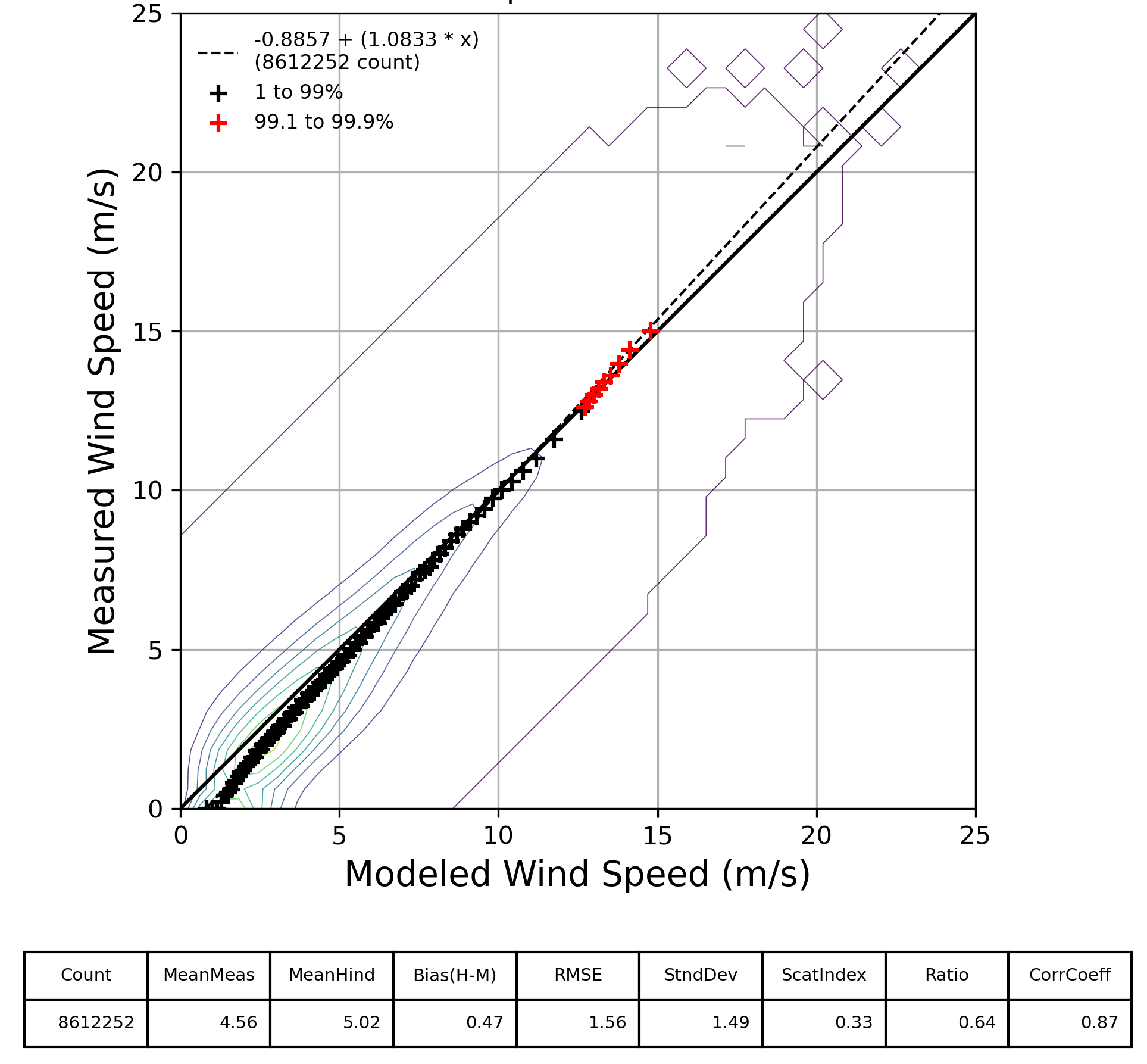
To quality control and validate the PERGOS-3 hindcast, modeled wind, wave and hydrodynamic parameters were compared to insitu and satellite measurements collocated in time and space. Despite relatively limited availability of remote-sensed measurements within the Gulf and uncontaminated by proximity to the coast, model comparisons of wind speed (WS) and significant wave height (HS) demonstrate low bias throughout including extreme upper 99.1-99.9%. Comparisons to private measurement programs in the Gulf show similar model performance.
Significant wave height (HS in m) comparison to available satellite altimeter measurements
|
_SBGP.png)
|
Wind speed (WS in \(\frac{m}{s}\)) comparison to available satellite scatterometer and radiometer measurements
|
_SBGP.png)
|
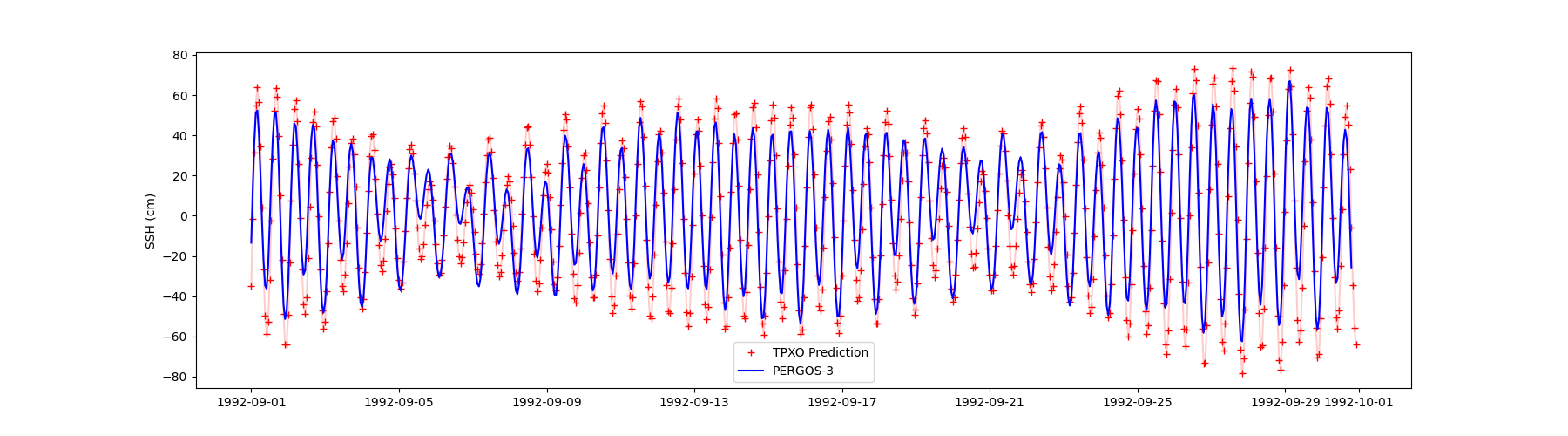
Tidal response comparisons to direct TPXO predictions
|
|