Evaluating the ERA5 Reanalysis at the 2018 WISE Conference
An evaluation of the latest European Centre for Medium-Range Weather Forecasts (ECMWF) reanalysis, known as the ERA5, is represented at the 2018 Waves in Shallow Environments (WISE) conference in Tel Aviv, Israel. Oceanweather (OWI) compared the ERA5 dataset against altimeter and buoy measurements from 2010 – 2016 using the 10-meter winds and significant wave height with focus on the wind forcing in the strongest tropical and extra-tropical events. Wind forcing has been shown to be a dominant source of error when applied in ocean response models for describing the peak events that drive design and operability in offshore and coastal applications and this informs potential users of deficiencies within the dataset.
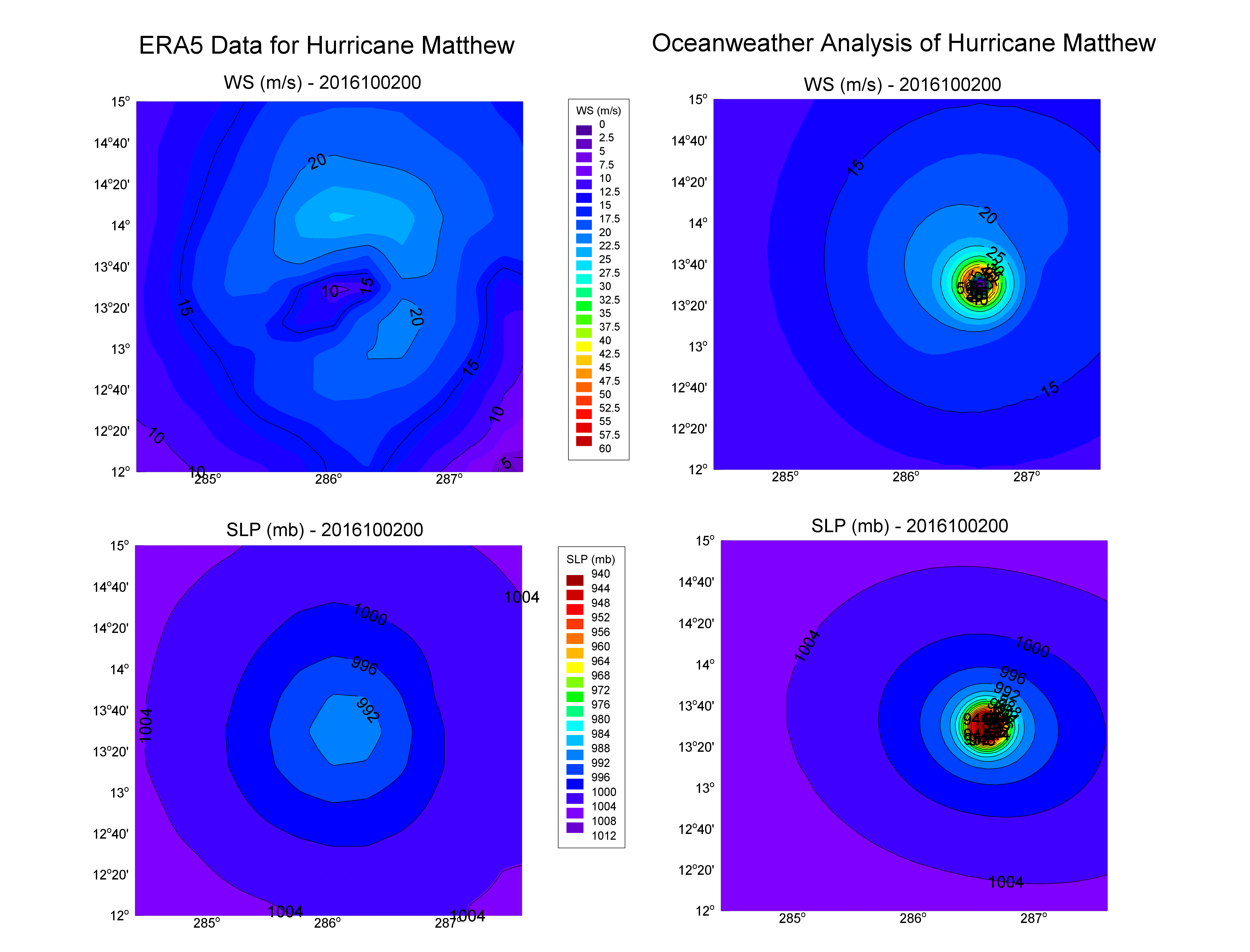
A specific example of a tropical cyclone (Hurricane Matthew, October 2016) within the ERA5 database and output from OWI’s Tropical Planetary Boundary Layer (TropPBL) model are given below. The figure shows the differences in SLP and WS: ERA5 minimum SLP is 991 mb while OWI has a minimum SLP of 940 mb, ERA5 maximum WS is about 23 m/s (average wind, neutral stability at 10 m) while the OWI analysis outputs 51.1 m/s (average wind, neutral stability at 10 m) which is consistent with the Tropical Prediction Center’s estimate of intensity.

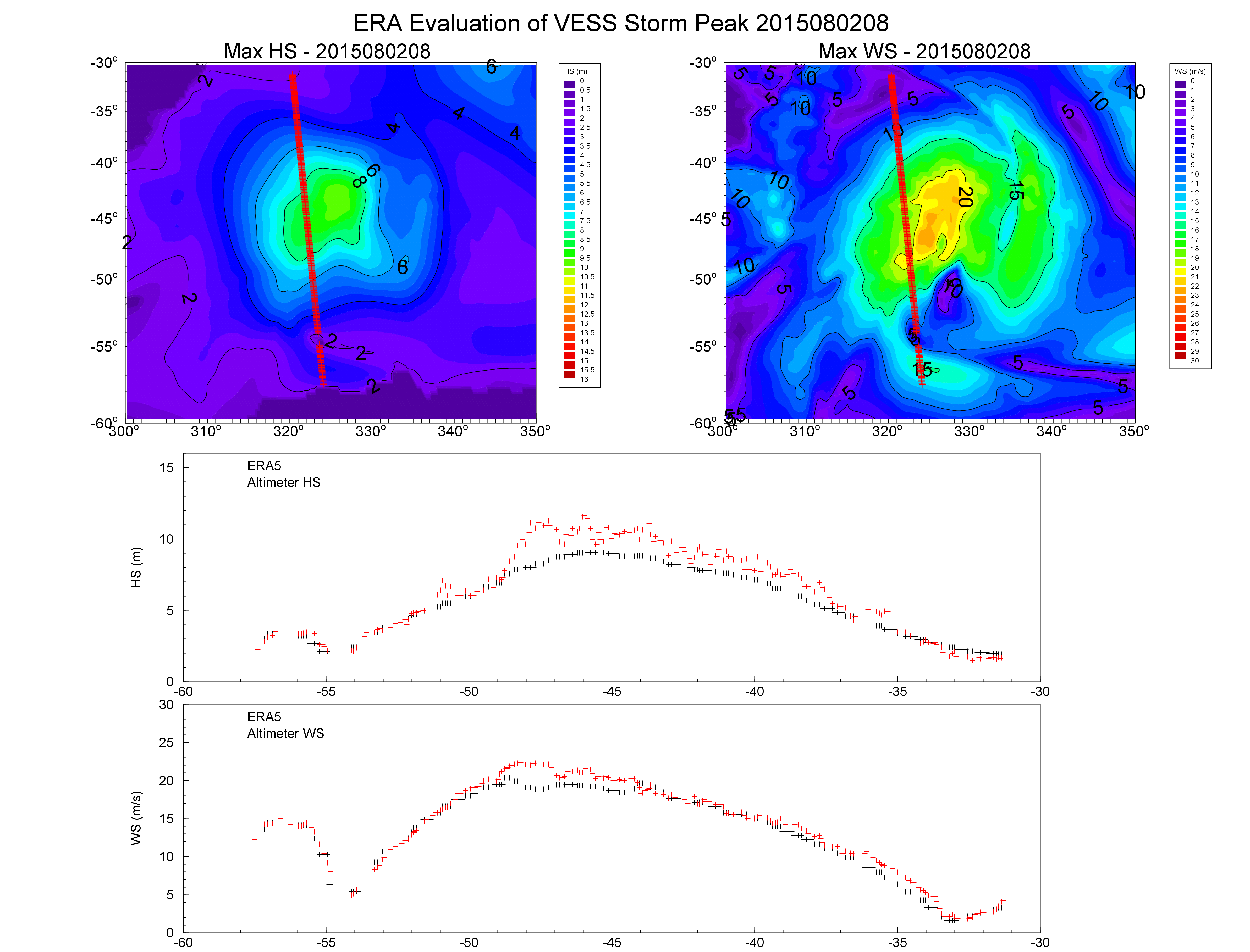
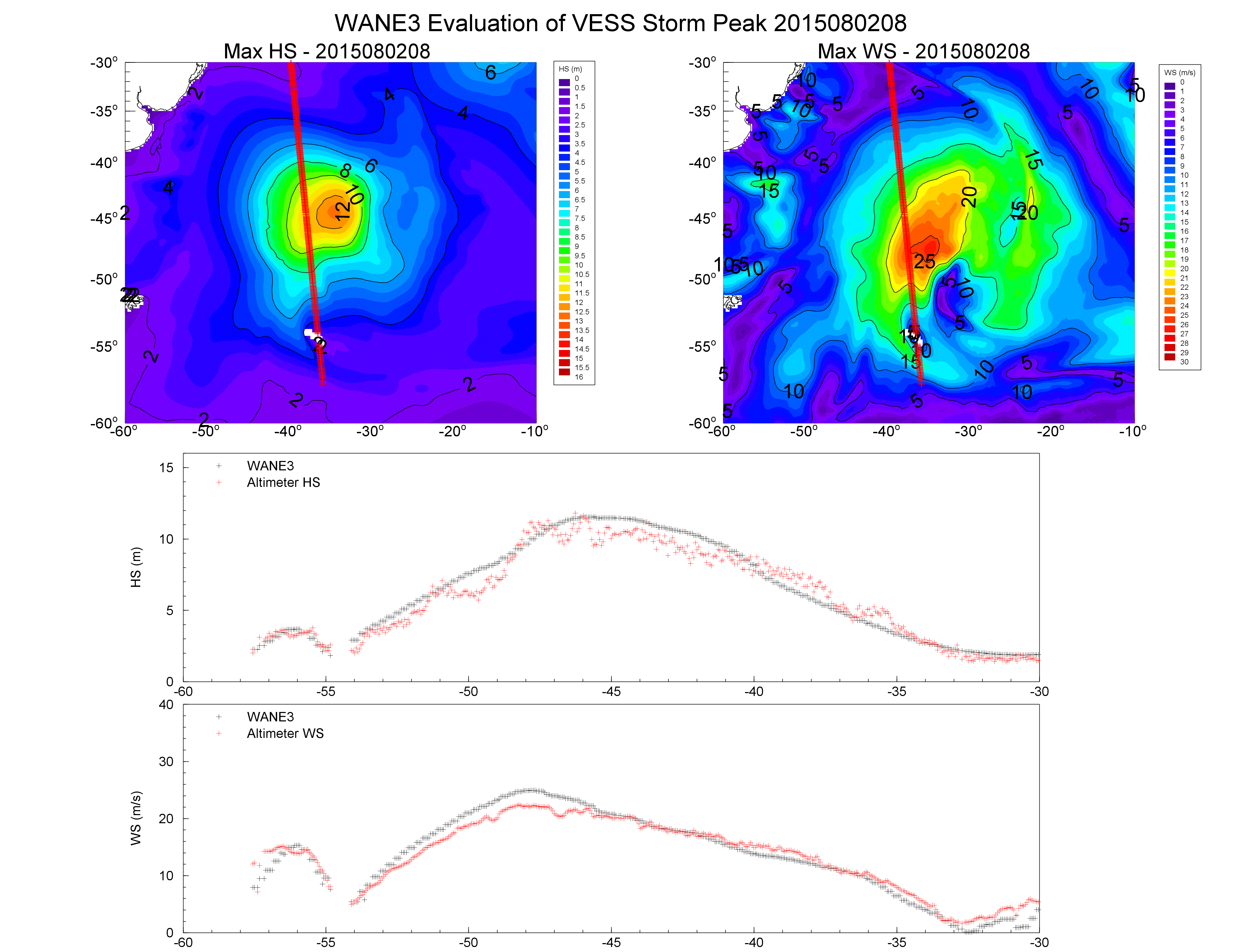
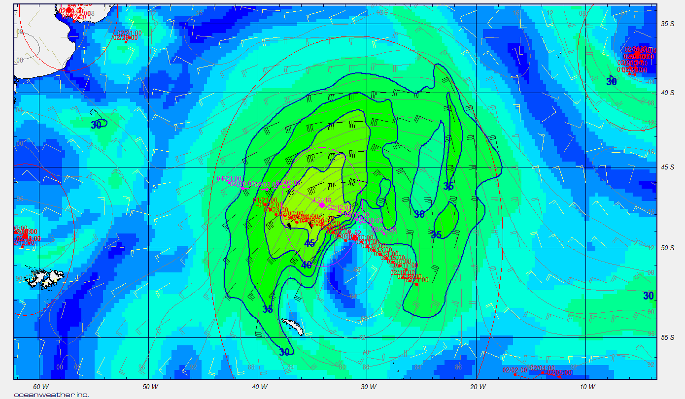
Deficiencies are also found in extra-tropical storms as shown in the example below from the South Atlantic comparing the ERA5 model data (below-left) and the associated altimeter pass at 0800 UTC 2 August 2015. The complementary figure (below-right) shows OWI reanalyzed winds from the West Africa Normals and Extremes (WANE3) hindcast at 0900 UTC 2 August 2015. An experienced meteorologist used all available data to determine the wind field as the storm progressed. The final analyzed wind field and resultant waves shows an manual analysis by an experienced meteorologist generates a better resulting wave field in comparisons to observations than that from the ERA5 output.
 |
 |
When examining individual events, deficiencies are found, in particular with extreme tropical and extra-tropical cyclones. Application of detailed analyses of tropical and extra-tropical systems can overcome the deficiencies in the ERA5 hindcast, improving its performance for both design and operability.

A full copy of the poster presentation is available in our recent publications page.